


20. Geotagging, GeoFinder, GPS, and KMZ
What are GPS or geocoding tags?
These are geographic locations, or GPS coordinates for files, and the process of adding them is called geotagging or geocoding.
Digital cameras always added information such as the F-Stop, exposure time, or the focal length into the EXIF data of the photo. Only lately are there a few cameras that also add the location where the shot was taken to the image.
NeoFinder will catalog that embedded GPS information in the EXIF section of photos and iPhone movies! While other tools only display geotags, NeoFinder can do a lot more with that valuable data.
With NeoFinder, you can find photos taken near a location (GeoFinder), or display the GPS location of the photo in web services, such as Flickr, Panoramio, Google Maps, MapQuest, SmugMug, WikiMapia, Yahoo Maps, or Geody.
NeoFinder is also the only tool to catalog not only the coordinates, but also the optional additional GPS altitude, view direction, tilt, and distance information, captured by newer camera add-ons.
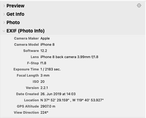
NeoFinder will display the GPS data in the Inspector, in the EXIF (Photo Info) section:
(please look at the "Location", "GPS Altitude" and "View Direction" fields)
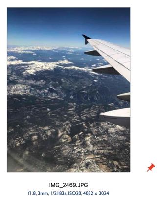
Also, any file, be it a photo or movie, with a geotag, has that cute red geotag icon attached to it in the bottom right corner, if displayed in Icon View:
What can you do with this GPS information? In NeoFinder, quite a lot, actually!
Read on:
20.1 The Map and GeoFinder
20.2 Add geotags to photos
20.3 The Wikipedia Inspector
20.4 KMZ Export
20.5 Get the place name
20.6 Edit GPS View Direction and Altitude